Pat Chavez - Adjunct Research Professor
Scott Kelly - Geospatial Specialist
David Scarbrough - SDNM
Landscape monitoring using remote sensing
NAU students in the Department of Geography, Planning, & Recreation study the desert
During the last 45 years, satellite remote sensing capabilities have dramatically improved in spatial, spectral, and temporal resolutions. Airborne imaging systems have also improved with very high spatial resolutions and hyper-spectral capabilities. Within the earth science community remote sensing has become an important tool to help study, map, and monitor the earth surface at scales ranging from global to local landscapes.
Use of remote sensing to help monitor land surface change in the Sonoran Desert National Monument
Landscape surface change can provide important information to land managers relating to environmental impacts of various types of land use and patterns. Change can often be detected using various field measurement techniques, however, the high costs in both money and time needed are often limiting factors. Remotely sensed imaging can be used to detect and map both temporal and spatial surface dynamics to help monitor large and/or isolated landscapes.
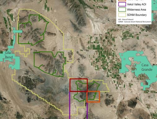
In the border lands area of Arizona public land managers are challenged by impacts to the Sonoran Desert landscape resulting from illegal activities and by increased use by visitors. Impacts to public lands that can affect the overall health of the landscape and impair natural resources and the public’s experiences includes illegal networks of vehicle routes and trails, accumulations of litter and debris, and damage to vegetation. Because of the potential of remote sensing to help monitor large and isolated landscapes the Bureau of Land Management (BLM) is funding a project at Northern Arizona University (NAU) to investigate the capabilities and limitations of remote sensing to monitor the Sonoran Desert National Monument (SDNM).
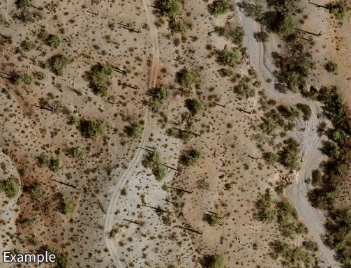
An important part of the project is to investigate the use of very high resolution satellite and aerial image data to identify the image characteristics (spatial and temporal resolutions) required to detect and monitor the travel network (roads and trails) in the SDNM. The remotely sensed image data being used for this task includes high resolution (50cm) satellite image data sets collected over a six year period along with a very high resolution (5 to 10cm) aerial image data set collected in 2011. Roads and trails over large areas have been detected and mapped using relatively simple 0.5m panchromatic satellite images. This type of information can be used to help with a proactive approaches to patrol by law enforcement and resource remediation by land managers.
Another project task is to include investigating vegetation cover and dynamics critical to different issues important to the BLM. This includes investigating the use of satellite imaging to detect and map the presence of vegetation at regional scales with potential applications for monument wide mapping and monitoring. Results include developing methods to generate digital maps that show the location, spatial distribution, and relative amounts of annual vegetation and perennial grass (fine fuels) cover, as well as bushes, shrubs, and other woody vegetation (coarse fuels). Results to date indicate that fine versus coarse fuels detection and mapping require very different types of remotely sensed satellite image data sets and the time of year the satellite images are collected. The techniques and methods being developed in this project will be applicable throughout the southwest.
General areas of study
Travel network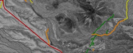
New and existing roads and trails over large areas where detected and mapped using relatively simple 0.5m panchromatic satellite images. The research included investigating the potential to detect, map, and monitor the travel network within Areas-Of-Interest (AOIs) through time. Besides detecting and monitoring new roads and trails we are interested in the potential to determine the relative activity level on existing roads and trails at any given time and/or change in the level of activity. This type of information can be used to help with a proactive approach to patrol by law enforcement and resource remediation by land managers.
Vegetation cover & dynamics (future link)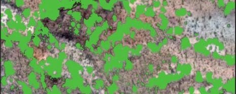
Desert vegetation is crucial for landscape sustainability and natural processes. Detecting, mapping, and monitoring the location and amounts of fine (annuals and grasses) and coarse (shrubs, bushes, and other woody plants) fuels are important for several landscape health related issues including wildfires, wind and water erosion, and wildlife habitats. This type of information can be used by land managers to help monitor some of the parameters related to both regional and local landscape health issues.
Elevation imaging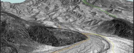
A spatial data set that complements remotely sensed satellite images are Digital Elevation Models (DEMs) which represent the topography of an area. Topography data of an area adds information that can help understand where and why roads, trails, drainages, vegetation, and other landscape elements exist.